Monday, April 25, 2011

Chapter 18: Hawaii

The textbook defines Hawaii as a string of islands and reefs 2050 miles long in the mid-Pacific beginning in the east with the big island of Hawaii and ending almost at the International Date Line beyond Midway Island with a small speck in the ocean called Kure Atoll.


A beautiful Sunset on the Big Island.

Hawaii and Washington D.C. could not be more different. Hawaii is a lush, tropical island with pristine beaches and near perfect weather in the Pacific Ocean. Washington D.C. is near the Atlantic Ocean, located somewhat inland, and experiences very hot summers and very cold winters. The lifestyle in Hawaii is calm and laid back, while people in D.C. are rushed, busy, and stressed. The two are physically far apart as well-4835 miles to be exact.


Washington D.C. and....

Hawaii. Very different yes?


An eruption from Kilauea volcano.


Additionally, very much unlike D.C., Hawaii has several active massive volcanoes. The volcanic activity that created the islands continues there today. Several Islands on the Big Island Remain active. Mauna Loa spouts lava about once every 4 years, and Kilauea is active only about once every 7 years.


Information from Textbook and Hawaii Wikipedia page.

Chapter 16: The North Pacific Coast

This chapter focuses on the North Pacific Coast, a region that extends from the very top of Northern California along the coast of Oregon, most of Washington, and through Canada into Alaska. This region is particularly known for its physical environment. Since it is mostly coastal, it is strongly subject to maritime influences and is pervaded by dramatically rugged terrain. Because precipitation is high, lush vegetation is found near the coast, but variations in flora and fauna exists over short distances.


An important part of the North Pacific Coast's economy is fishing. The North Pacific's cold water were, and to an extent still are, fertile fishing grounds. Salmon has been the fish of greatest import in the North Pacific Coast for a long time. It was a major food and economic mainstay of coastal tribes before Europeans arrived and is still the principal fish caught in the region.


Chinook Salmon--a type of Salmon found in the North Pacific Coast's waters.


Though D.C. is not a hub for commercial fishing, fishing hobbyists come out to D.C. to fish for fun. Fishing in the District of Columbia may be limited (as there are no lakes), but the area still offers quality fishing. The Potomac River, its tributaries and Rock Creek make up all the best fishing ground.

The fish found in D.C.'s rivers are: Bass, Catfish, Panfish, and Crappie.

Many people who fish in D.C. fish for Bass, a highly sought after fish. Bass is quite prolific in 
the Potomac River.

A man catches a Bass in the Potomac


Additionally, hobbyist groups like the Potomac Bassmasters have formed in response to the fishing conditions in D.C. Potomac Bassmasters of Virginia (PBV) is one of the oldest bass angling clubs in the greater Washington, D.C. area. The club is a not-for-profit organization dedicated to the advancement of bass fishing, conservation, and youth involvement in angling. Its members generally come from Virginia, Maryland and Washington, D.C., and share a common passion for bass fishing.

Fishing in the Potomac


The PBV has been hosts fishing tournaments on the Potomac River, spons public events in support of the community, and holds an annual youth fishing derby. The Potomac River is PBV’s home water but club tournaments have been held in northern and southern Virginia, North Carolina, Maryland, Delaware and other regional locations. 


Information from:
1. Textbook
2. DC Bass.com

Chapter 15: California

This chapter is entirely dedicated to the great state of California (not that I'm bias or anything). This chapter covers almost everything about California-the physical geography, the climate, the cities, the tourism, the agriculture, the water supply, and transportation. In this post, I am choosing to focus on comparing the transportation and traffic congestion of Washington D.C. and Los Angeles.

LA Traffic

 Having grown up in the L.A. area, I know the automobile culture that is so vital to Californians. The textbook states that, "today, nearly half the central portion of Los Angeles has been surrendered to the automobile, either for roads or parking. A dense system of freeways encourages high speed movement across the metropolitan region." The Los Angeles area has more cars per capita than any other part of the country, and only a minimal pubic transportation system exists. Anyone who has spent a couple hours in L.A. traffic can attest to this.


Even though D.C. has a much better public transportation system and not as many cars as Angelenos, D.C. still experiences a great amount of automobile congestion and traffic.

Going into and out of the city center can be painful. I checked a D.C. traffic report throughout the day, and streets/freeways going into and out of the city center did not change from the stop and go red. 


According to the DCist, in 2007 D.C. was in a three way tie for second place in the contest for the Worst Traffic in the Nation award. They tied with Atlanta and the Bay Area--only Los Angeles beat them out.
Washington D.C. also is one of the worst places to go during Thanksgiving. A study concluded that the interstate 95 corridor between Washington D.C. and New York City made the top slot for worst traffic during Thanksgiving. 


Traffic on D.C. streets


To add to the congestion, any time a foreign dignitary or the president goes somewhere, streets are blocked off and traffic jams are exponentially increased.


A presidential motorcade causes more traffic in D.C.


Though D.C. has a much better public transportation system than LA, the city still endures large amounts of congestion.


Information from:
1. The textbook
2. DCist.com

Chapter 14: The Southwest Border Area: Tricultural Developement

The Southwest is a culture region distinguished by coexisting Spanish, American Indian, and Northwest European American people. Each group brings different cultures and characteristics that help make up the “melting pot” society of the Southwest.


Like the Southwest, Washington D.C. is an area with great cultural diversity. Unlike many American towns, it is a city without one homogeneous identity. The biggest indicator of this cultural diversity is that the minority populations in D.C. are much higher than in the rest of the country. Another huge difference is that white people are not the majority population in D.C. they make up 40.6% of the D.C. population compared to  79.6% overall in the U.S.

In 2009, the largest minority population in D.C. was the black population. In the district, black persons make up 54.9% of the population, as opposed to the general U.S. percentage of 12.9. It was the first city with a majority black population. Although numbers of black people are beginning to decline in the city, D.C. is an area where the minority black population is well represented. In this way, D.C. is a rich city with many different minority groups and races.

The East Coast, and especially D.C. enjoys a higher percentage of black population than the majority of the country.


Chapter 13: The Empty Interior

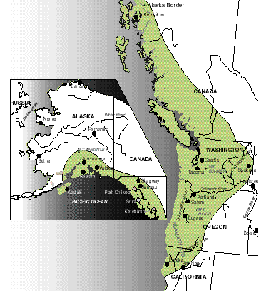
The Empty Interior is defined by the textbook as a region of sparse population south of the Arctic. It stretches from the Rocky Mountains eastern slopes west to the Sierra Nevada of California, the Cascade Range of the Pacific Northwest, and the Coast Mountains of British Columbia. Most inhabitants of the empty interior are of Northern European origin, although Hispanics and American Indians form significant proportions the south.


Though Washington D.C. is not in this region and enjoys a vast population unlike the Empty Interior, both regions are host to thousands of tourists every year. 
The great variety and appeal of the scenic wonders in the Empty Interior attracts millions of visitors each year. Beautiful national parks like the Grand Canyon, bring thousands of tourists into the area that help support motels, snack bars, gift shops, and other service industries near these natural wonders. One of the most substantial places for tourism in the empty interior is Las Vegas. As soon as Nevada passed laws legalizing many forms of gambling and simplifying divorce proceedings, the state became the gambling and divorce capitol of the nation. People from all over the world and nation flock to Las Vegas for it’s world class shows, hotels, and casinos.

The Las Vegas Strip


Washington D.C. also has a robust tourism economy. In 2007, Washington hosted 16.2 million visitors, generating an estimated 5.24 billion visitor spending in the city alone. Eight percent of visitors are from abroad. The top countries the international visitors come from are the United Kingdom, Germany, Latin America, Japan, India, South Koriea, Nordic, Australia, Italy and France. 
People come to D.C. to see the famous monuments of the nation’s capital and the world renowned museums. The most popular attractions include:
Smithsonian’s: National Museum of Natural History (7 million visitors)
National Air & Space Museum (6 million visitors)
National Museum of American History (3 million visitors)
National Zoological Park (3 million  visitors)
Lincoln Memorial (4 million visitors)
WW II Memorial (4 million visitors)
Korean Memorial (7 million visitors)
FDR Memorial (7 million visitors)
Rock Creek Park (7 million visitors)


The Lincoln Memorial


Information gathered from textbook and WashingtonDC.org statistics.


Wednesday, April 20, 2011

Chapter 12: The Great Plains and Prairies

The Great Plains is a region that stretches from the southern tip of Texas through New Mexico, Colorado, Wyoming, Montana, all the way to Alberta on the west, and runs through North and South Dakota, Nebraska, Kansas, and Oklahoma on the East. The region has some of the least variation in vegetation and topography of any region in North America.


D.C. is not located in the Great Plains region, but both D.C. and the Great Plains have rich native American history.


For the Plains Indians, hunting, particularly for buffalo was the primary economic activity and most tribes lived along the streams in semipermanent settlements. With no means of rapid, long-distance overland movement, the Indians could not leave the dependable water supplies of the streams for long periods. This was a substantial problem, for the migration of the great buffalo herds often took this food source far away from settlements for many weeks.


Great Plains Indians--1880


When Spanish explorers departed from the souther Plains in the sixteenth century, they left some of their horses behind. This action dramatically altered the Plains Indians' lifestyle. When the Euro-Americans reached the great Plain in the early nineteenth century, they found what many have called the finest light cavalry in  world history. Plains indians were no longer restricted to the region's sparse waterways and freely followed the buffalo migration. Horses enabled the Indians to thrive as never before. A few tribes, like the DAkota (Sioux) in the north, the Apache and the Comanche, dominated large sections of the Great Plains.


The horse completely changed the American Indians' lives.


D.C. Indians


The Piscataway tribe lived along the Piscataway Creek in the Prince George's region of Maryland up to our Washington D.C. Most of the tribe settled comfortably in small villages and camps along the Chesapeake Bay. The men built wigwams and "dug-out canoes," while the women made pottery and baskets. It is said that these "physically dark, very tall, muscular and well-proportioned people" enjoyed their way of life and they only looked to obtain one thing: peace.
Europeans meet the Piscataways   
On March 25, 1634 when Lord Cecil Calvert and his Catholic crew landed and began establishing the English Colony of Maryland. Because the native Piscataways had already settled in the area, Calvert's conquest didn't go over as smoothly as he thought it would. Calvert decreed that everyone in the land convert to Catholicism, but the Piscataways practiced their own traditional religion, and could not interpret the English language to remotely understand a foreign faith. Therefore, the Piscataways had no idea what Cecil Calvert was talking about, but when he "composed a grammar, dictionary and catechism in [their] dialect," Algonquian. 
 Time and time again, Calvert and company came to convert them, but they held fast to their beliefs and did not give in. With time, the Piscataways were asked to leave the prime lands around the Chesapeake. Not only did they receive an eviction notice, in the Northwest, the Susquehannocks, "a warlike tribe," also sought to drive the Piscataways out from their land and "destroy them." In doing so, the Susquehannocks, who were a powerful Native American warlike tribe, also sought to drive the Piscataways out from their land and "destroy them." 
Hardly anyone knows what happened to the Piscataways, and they have been all but forgotten in modern society.

Information from:
1. Textbook
2. D.C. Pages, Origins of the Piscataway

Chapter 11: The Agricultural Core

The plains of North America's interior are a huge, undulating swath of land. The interior plain's western portion is dry and dominated by grasslands--it is the area that is known for its grand boundless openness, s--known as the Great Plains and Prairies. However, the eastern plain is quite different. The air is humid throughout the growing season (helping produce different vegetation), and it rains much more often. The agricultural core is defined by its small town, rural America.

Washington D.C. is a metropolitan area and not a rural farming area, but D.C. shares common ground with the Agricultural core in that both area's land and cities are laid out in a grid format.

Through the land ordinance of 1785, the Land Ordinance of 1785, land north of the Ohio River and west of Pennsylvania was delimited according to a regular, rectangular township and range survey before it was opened to settlement by the newly independent U.S. States. A series of east-west baselines and north-south meridian lines were drawn, and township squares 6 miles on each side were laid out with respect to these lines. Each township was further divided into 36 sections of 1 square mile.

A modern example of the Township and Range model


Though not farmland, the city of Washington D.C. is divided into similar grid-based areas.

Wikipedia states that, "L'Enfant incorporated a basic grid system, inter-cut with broad diagonal avenues radiating from rectangles to provide open spaces and vistas. His design also envisioned a garden-lined "grand avenue" approximately 1 mile (1.6 km) in length and 400 feet (120 m) wide in the area that is now the National Mall.[3] In 1792, surveyor Andrew Ellicott revised L'Enfant's plan, creating the design that the federal city's development followed.[4][5]"

L'Enfant's original plans for the city of Washington D.C.


He used the United States Capitol as the center from which the four other quadrants (Southwest, Southeast, Northwest, and Northeast) stem from. The quadrants are separated by North Capitol Street, South Capitol Street, and East Capitol street, with a line traveling west from the Capitol through the Jefferson Pier on the National Mall serving as he fourth border line. Constitution Avenue and Independence Avenue line the sides of the area.

North/South streets are designated by numbers and count upwards from east to west in the Northwest and Southwest quadrants of the city, starting at the capitol. In the Northeast and Southeast Quadrants, these streets repeat, but count upwards from West to East, going away from the capitol. East/West streets use a single letter of the alphabet. Street letters count upwards traveling outward from the dividing lines of the quadrants, however, there is no J street.


All information from Washington D.C. Tourism site, the Textbook, and Wikipedia.